One of the first articles I wrote for this blog illustrated the theory at the basis of my understanding of urban dynamics, that transport defined how a city grew and how it functioned. That the faster people travel around, the more developments will sprawl, because distance is measured in minutes, not miles, and proximity to a city's jobs and services is the reason why people live in the city in the first place.
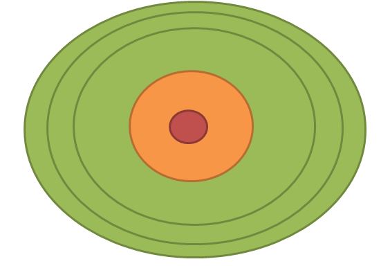
A conclusion that I draw from this theory is that the size of a city is dependent on the speed of the main transport mode of residents. Hence why old cities tend to have clearly defined edges at roughly 5 kilometers from the center, which is the equivalent of one hour of walking.
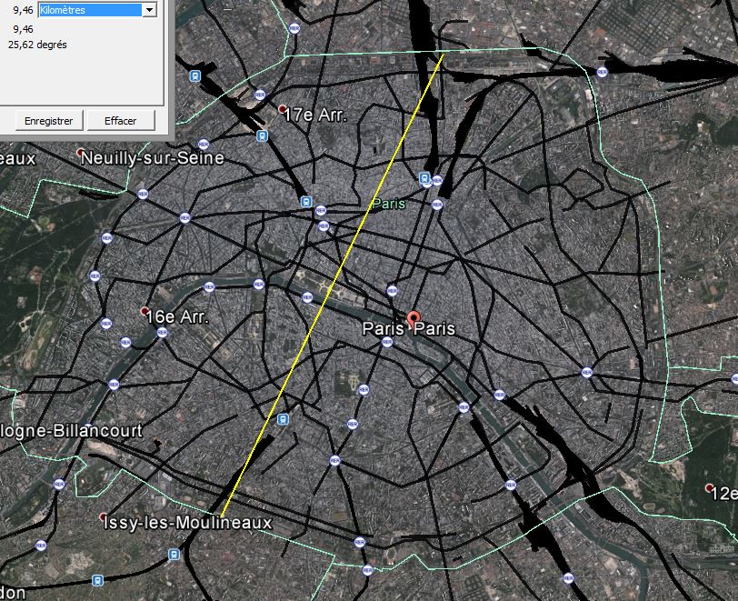 |
| Traditional Paris city has a diameter of 10 km, meaning people on the limits of the city can reach the center in one hour on foot |
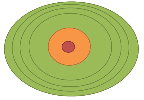
In effect, transport speed imposes an urban growth boundary on cities, if the area grows too large, the fringes become decoupled from the center of the region because it takes too much time to access the rest of the region. So, in a way, supposing a certain transport speed, you can imagine that there is a limited supply of land of varying quality in an urban area, depending on proximity to the center of economic activities and services, always remembering that proximity is measured in minutes, not miles.
So let's come up with an example of a city in a given area that looks like this:

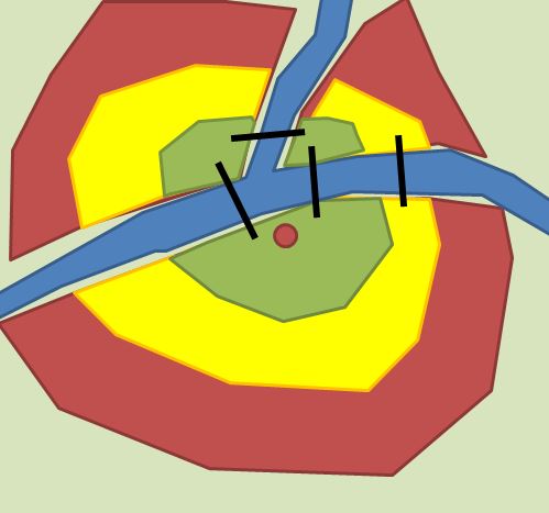
OK, so you have a river that cuts the area in three, there is only one bridge that allows to cross one branch of it, and the red dot represents the downtown of the urban area. Next, I'll divide the area between green, yellow and red areas, with the green representing the most desirable land due to proximity to downtown's jobs and services, the yellow representing lesser desirable locations and red representing marginal locations that stretch people's tolerance of distance.
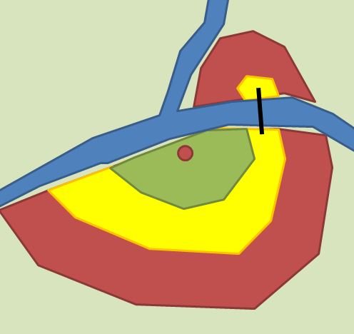
So this represents roughly the city's "land supply". It roughly resembles three concentric circles, but the river is an obstacle to land supply, the only desirable locations north of the river is near the bridge to the east.
Note that this supposes that everyone travels at the same speed, which is not correct. People who expect to drive everywhere will tolerate much greater distances, land that is undesirable for a non-driver may yet be desirable for a driver.
If I were to ask where you would expect higher densities of construction, I'd wager most would say that the highest densities should be in the green area, the yellow should be lower density and the red should be low density. After all, cities can't and shouldn't be of uniform density everywhere, different people have different desires and needs, and higher densities should ideally be near jobs and services to allow as many people to access them in a short time as possible, that way you reduce transport needs for the entire city, while preserving people's ability to choose low-density housing if they so wish.
Well, that makes a lot of sense... if you were to build the entire city from a master plan in one shot. But that's not how cities are built, cities are built in stages over decades. Every year, the city's planners and developers make decisions that make sense for them at that moment in time.
Understanding this leads me to what I call the "onion layer theory of sprawl".
The onion layer theory of sprawl
The theory is based on the idea that low-density housing is actually the proper kind of development to expect from building on the fringe. The fringe is where land is most abundant and less desirable, so that it is cheaper. When a product is cheap, people tend to use more of it than absolutely necessary, that's true for gas, that's true for human labor and that's true for land. So having a bigger plot of land is affordable on the fringe.
For the planner, low-density housing is also more tolerable on the fringe. If you have a given amount of land on the fringe, since the location results in higher transport needs (people driving more often and longer distances), it's better to have fewer people there.
To use the earlier example, let's imagine we're only looking at a small town here, with the following urban area already built:
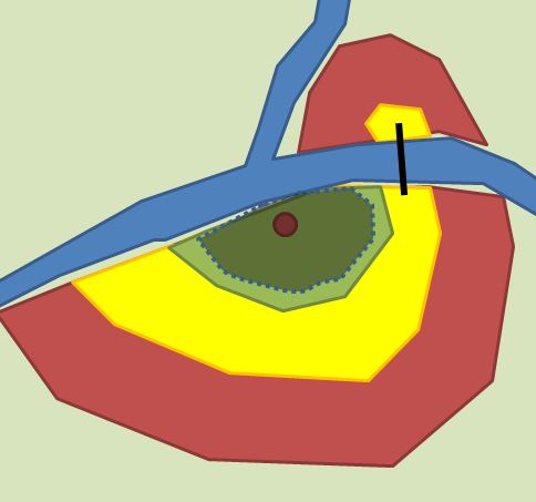
In this case, the green, desirable, land is still not fully built, the yellow, less desirable, land is still completely empty. If the city grows 1% each year, there's still plenty of land to go around, even green land, so the value of land will be very low. As a result, building low-density is affordable, and so it will likely be what ends up getting built.
Now, after a few years, the built area keeps growing and growing and you may get the following:

At this point, the desirable land is almost all gone, which will drive the value of land up in that area. However, on the fringe, there's still plenty of yellow land to go around, so the land value over there will be much cheaper, again, the new layer of construction will likely be low-density too, with a smattering of higher density housing in the remaining green area to develop.
And so it goes on :

Again, you are running out of yellow land, and now only the marginal land remains largely undeveloped. Again, lots in the green and yellow areas will see their value increase significantly, but there are few of them left. Meanwhile, land in the red area will remain largely affordable, inciting the new layer of development to again be of low-density.
So the resulting urban density looks a bit like this:
 |
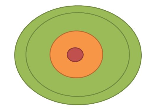
| This is how the city starts, in red, the dense downtown, in orange the mid-density neighborhoods close to downtown, in green, the low-density suburbs |
 |
| The first layer after development begins, since land is cheap on the fringe, it's likely to result in low-density developments |
 |
| Another new layer of low-density developments |
 |
| And on and on it goes... |
So is there a way out? Well, the traditional answer was incremental construction, with progressive densification of the core even as the fringe was still being built. But with the advent of strict zoning rules, this way is too often closed, resulting in an almost uniform low-density sprawling city.
Ironically, at one point the city's sprawl may make it run out of land withing tolerable distance from the city's core. At that point, the planners and developers may both agree to start building higher density as land gets more expensive. This is not that uncommon, many metro areas have higher density developments in farther suburbs than inner suburbs because of that, since farther suburbs are more recent.
For example, here is a Google Earth image from the fringe of Calgary's urban area:
 |
| Recent developments on Calgary's fringe, dense single-family housing and 4-story apartment buildings |
And here is an image from a neighborhood within 30-minute walk of downtown:
 |
| This leafy, low-density area is 30 minutes on foot from downtown Calgary |
 |
| Location of previous images |
Yes, you can build more land...
"Buy land, they're not making it anymore" is a common saying, attributed to Mark Twain. However, that is not true on an urban level. You CAN build land, or rather increase the supply of land of a given desirability. If you build transport infrastructure to increase travel speed, you are expanding the distance people will be willing to travel, which effectively increases land supply for urban development.
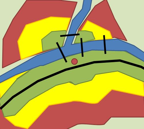
For example, let's return to the example before:

In this particular case, there is an obvious problem in that the river keeps land to the north of it from being desirable, as they're disconnected from the downtown area. But if you build new bridges, then...
...you can significantly expand the amount of desirable land for development. And if that's not enough, you can also speed up travel significantly in a given corridor by building an expressway passing near downtown:
This realization is important to understand the role freeways have in North American sprawl. Freeways, that are funded by Federal and State/provincial governments, are built in urban areas, which allows the supply of land to be significantly increased, yet those who benefit from this infrastructure largely do not have to pay for them. In effect, the DOTs/transport ministries are deeply involved in urban development because of this, yet they pretend ignorance and innocence in order not to get sucked in such debate.
Sprawl in North America is thus dependent on the construction of new roads all the time in order to increase the supply of land, and thus keep land prices low enough that low-density developments remain financially viable. This is in fact a great subsidy for sprawling cities and their suburbs. When that scheme fails due to geographical limits, like in Vancouver for example, then sprawl crashes and prices explode.
In recent years, some governments have started talking of the possibility of taxing land around transit as a "value capture" option... which is absolutely stupid since transit is largely funded by users and the people who reside near it already. If there is a reason to do this kind of "value capture", it would be to do it for freeways, not transit, since freeways are currently funded through indirect taxes on everyone and not through fees on users.
Conclusion
So I know a lot of things I wrote here may seem almost self-evident, but it's important to keep in mind that they have consequences. For one, since it makes sense to build every layer of a city's expanding border as low-density when it is built, it's important to make sure that our zoning and planning rules allow these areas to later densify organically to accommodate a rarefaction of land in the city, otherwise, prices may well explode. Likewise, since transport infrastructure spending increases the supply of land, it's important to take this effect into consideration, and ideally to charge those who benefit from them rather than simply fund such spending through general revenues.